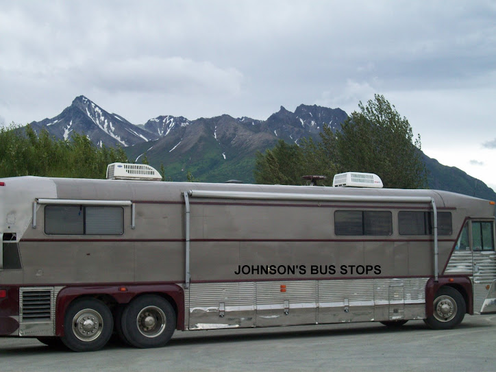
We made it back to the U.S. Yesterday we left Raduim Hot Springs and drove south on highway 95 crossing into the U.S. at Eastport, Idaho. There was a line of cars at the border but fortunately it moved quickly. The border guard who questioned us for a few minutes had an odd style of questioning and we were unsure if this reflected a lack of social skills or an attempt to intimidate or throw us off our guard, but it was quick and not really unpleasant.
We used the last of our Canadian cash to pay for the campground (they do it like a hotel, where you pay when you check out). We were past the point where we usually fill up with fuel, but we guessed correctly that fuel would be cheaper in the U.S. than in Canada so we waited to fill up after the border. In lieu of a truck stop we pulled into a gas station with a lot of room. The fuel was cheaper than we have seen for some time and offered a 5 cent a gallon discount for cash. Dennis went in to ask if they needed prepayment for the cash price. When they said yes, he said "here's $400 for pump 5", and the startled clerk who had not seen what we were driving seemed astounded saying "You want $400 worth of gas!" Fortunately we only needed 125 gallons so we got some change.
Dennis has been concerned about an oil leak in our engine. The mechanic who changed our oil in Whitehorse said that it needed to be repaired by an engine shop but should be able to wait "until you get home" which was reassuring as he had noticed the Florida plates. But we decided to contact the Detroit Diesel shop in Spokane as we can't really see an advantage to waiting to get the problem repaired and we have the time now. We had been told they would look at it today but when we called to confirm they said they were really busy and asked if we could come in tomorrow instead. So we decided to stop for a couple of days at the Little Diamond NACO park in Newport, Washington. This is a relaxing place with a lot of room and a lot of woods and not many people. There is not a lot to do but we don't mind for a couple of days. We will go on to the shop tomorrow.
We are noticing signs that we are back. We got back just in time for a warming trend. We ran our a.c. today for the first time in at least 2 months. And it gets dark before we go to bed. It seems odd now for it to be dark at 9 o'clock in the evening.
Showing posts with label british columbia. Show all posts
Showing posts with label british columbia. Show all posts
Wednesday, August 19, 2009


Saturday, August 15, 2009
Raduim Hot Springs
We are now at the Raduim Valley Vacation Resort in Radium Hot Springs, B. C. This is a very nice RPI park, probably the nicest that we have stayed at. They have very long 50 amp. full service sites, just a little close side to side. Each site has a small cabana with a grill. It is a well kept park with a nice recreation building with pools and hot tub and a nice excercise room. They provide cable tv with a lot of channels. Although they have a wifi hotspot in the rec center, we opted to pay extra for a cable modem which is probably the best internet connection that we have ever had on the road.
We drove less that 100 miles yesterday morning from Lake Louise. It had rained most of the night and still some rain in the morning. We drove through the mountains going from Banff National Park to Kootenay National Park which ended just before the little town of Radium Hot Springs. We saw some fresh snow above us on the mountains. The only wildlife that we saw on the drive was several elk.
Raduim Hot Springs and Invermere a few miles to the south are 2 of the resort towns in this mountain area. Radium Hot Springs is named for the springs in Kootenay Park just up the mountain from the town. We saw something saying that Radium Hot Springs is also the Bighorn capital of B.C. We weren't much impressed until we saw a few of these guys stopping traffic in the middle of town.

We mostly took it easy today, and did a little local site seeing. We have moved every day for 8 days in a row and that is tiring. We plan to stay here two more nights before crossing the border on Monday. We drove into Invermere this evening and had a very good meal at the Oriental Palace.
This gull looks like it is larger than the boat.
 The Columbia river seems to be much smaller here than in Electric City, Wa

We drove less that 100 miles yesterday morning from Lake Louise. It had rained most of the night and still some rain in the morning. We drove through the mountains going from Banff National Park to Kootenay National Park which ended just before the little town of Radium Hot Springs. We saw some fresh snow above us on the mountains. The only wildlife that we saw on the drive was several elk.
Raduim Hot Springs and Invermere a few miles to the south are 2 of the resort towns in this mountain area. Radium Hot Springs is named for the springs in Kootenay Park just up the mountain from the town. We saw something saying that Radium Hot Springs is also the Bighorn capital of B.C. We weren't much impressed until we saw a few of these guys stopping traffic in the middle of town.

We mostly took it easy today, and did a little local site seeing. We have moved every day for 8 days in a row and that is tiring. We plan to stay here two more nights before crossing the border on Monday. We drove into Invermere this evening and had a very good meal at the Oriental Palace.

This gull looks like it is larger than the boat.
 The Columbia river seems to be much smaller here than in Electric City, Wa
Monday, August 10, 2009
Almost to Mile Zero
Tonight we are at the mile 80 rest area on the Alaska Highway. The highway was curvy with a number of steep grades some of which we had to climb in first gear. But we got an early start and might have made it to Mile 0 of the Alaska Highway at Dawson Creek but we had more construction stops than we have seen before. We followed pilot cars 5 or 6 times, some after long waits. It makes for slow traveling and a long day.
We drove through the Rocky Mountain section of the highway. We had many great views of the mountains and saw more variety of wildlife than we had seen on any day except when we took the tour bus at Denali.
The wildlife that we saw included buffalo, elk, caribou, and stone sheep.
 These stone sheep were really cool, they walked in front of the bus as we pulled over, then they ran down the side of the road, almost disappearing in all the rocks.
 these two were on the other side of the road and the one seem to be saying talk to the butt!!
 this is a lone caribou
Sunday, August 9, 2009
Hot Springs Tonight
We had an easy drive today from Watson Lake to Laird Hot Springs Provincial Park. We had heard a lot about the hot springs here as being a don't miss along the Alaska Highway. We got here about noon and it seemed too soon to stay but we weren't sure we would feel like driving after a good soak in the hot springs, so we took a spot for the night. It was $19 for a no hookup spot for the night which seems high, but it includes free use of the hot spa which is ordinarily $5/person, so in a sense we are only paying $9 for the campsite. In any case, the campsites are large and wooded, a pleasant setting, and easy to maneuver in our bus. We enjoyed the hot springs in the afternoon so much we returned again in the evening.

Looks like Dennis needs to get back in the sun and improve his tan.
The drive over was easy. The highlight was a close look at this buffalo walking along the road.
 this is a really big guy.

Looks like Dennis needs to get back in the sun and improve his tan.
The drive over was easy. The highlight was a close look at this buffalo walking along the road.
 this is a really big guy.
Friday, June 12, 2009
Atlin, B.C.
We backtracked a bit today and visited Atlin in our car. The road to Atlin from the Alaska Highway was gravel about half of the way but in good shape. Traffic was light. There were great views of scenery.

This a really nice sign along the road.

Even the rest areas were nice.

We stopped to look for mountain goats at a viewing area but did not see any.
We saw several bears on the drive. A young grizzly on the side of the road.

A large back bear crossed the road in front of us on the way back. We had a good view of a mother grizzly with 2 cubs. Big Momma grizzly with two new cubs, didnt seem to even notice the number of cars taking photos of them as they grazed along side of the road.

The town overlooks beautiful lake Atlin. We had an excellent lunch at a small restaurant on first street. These are some pictures from Atlin. This is an old tour boat at Atlin.

Roxie and Barbara took a short break on this psychedelic bench down by the old tour boat.

Tuesday, June 9, 2009
Signs of Yukon
We got up early and continued up the beautiful but increasingly rough Cassiar highway. Another long patch of gravel road was followed by various rough spots, spot repairs, and short stretches of gravel road. The constantly changing condition of the road made it difficult to drive. We could not keep the GPS attached to the windshield as the bumps would shake it loose. We also had a support holding a cabinet shelf break and our printer fell and may be damaged.
The highlight of this segment was seeing two Bighorn Sheep just along the road. We were able to get a picture of one of them.
.
We crossed into the Yukon and reached the junction with the Alaska Highway and got fuel. At $1 a liter for diesel, the price was the highest I've seen this year, so I bought just enough to get to Whitehorse with the idea that the price will be lower in a larger city - that remains to be seen. We got permission to leave the bus in their huge parking lot and drove the 14 miles east to Watson Lake and back in the car. We walked through the famous signpost area at Watson Lake. Although we expect to pass through Watson Lake on our way home we felt a visit there belonged as part of the experience of going to Alaska. The number of signs and variety of types of signs, locales referenced and range of dates makes you feel part of a large group of co-travelers. Dennis' parents visited here on a trip to Alaska about 16 years ago and remembered it as impressive then. They did not remember if they or any of the group they traveled with had left a sign. We attempted to look for signs of that era but it looks like one would really need to know where to look to have chance at finding a particular sign.

We returned to the junction and took the Alaska Highway which is also a 2 lane road but unlike the Cassiar it it has a berm on each side and it is smoother but still has some rough spots and construction. We saw 2 moose off to the side of the highway but were unable to get a picture as there was a truck behind us preventing us from stopping safely. We took a side highway to Carcross where we plan to spend 3 or 4 nights and visit Skagway, Alaska and probably Atlin, B.C.
We are staying at Montana Services RV Park in Carcross. It is basically a gravel parking lot with fairly large spaces marked off by logs, but it has all of the amenities that we want for a reasonable price and we won't be spending a lot of time in the park.
The highlight of this segment was seeing two Bighorn Sheep just along the road. We were able to get a picture of one of them.
.

We crossed into the Yukon and reached the junction with the Alaska Highway and got fuel. At $1 a liter for diesel, the price was the highest I've seen this year, so I bought just enough to get to Whitehorse with the idea that the price will be lower in a larger city - that remains to be seen. We got permission to leave the bus in their huge parking lot and drove the 14 miles east to Watson Lake and back in the car. We walked through the famous signpost area at Watson Lake. Although we expect to pass through Watson Lake on our way home we felt a visit there belonged as part of the experience of going to Alaska. The number of signs and variety of types of signs, locales referenced and range of dates makes you feel part of a large group of co-travelers. Dennis' parents visited here on a trip to Alaska about 16 years ago and remembered it as impressive then. They did not remember if they or any of the group they traveled with had left a sign. We attempted to look for signs of that era but it looks like one would really need to know where to look to have chance at finding a particular sign.

We returned to the junction and took the Alaska Highway which is also a 2 lane road but unlike the Cassiar it it has a berm on each side and it is smoother but still has some rough spots and construction. We saw 2 moose off to the side of the highway but were unable to get a picture as there was a truck behind us preventing us from stopping safely. We took a side highway to Carcross where we plan to spend 3 or 4 nights and visit Skagway, Alaska and probably Atlin, B.C.
We are staying at Montana Services RV Park in Carcross. It is basically a gravel parking lot with fairly large spaces marked off by logs, but it has all of the amenities that we want for a reasonable price and we won't be spending a lot of time in the park.
Monday, June 8, 2009
Up the Cassiar
We were a little slow in deciding whether to stay another day at Stewart. It was nice there, but we felt that we had seen most of what we could see in the area and we were aware of having a lot of miles to go, so we decided to move on. We didn't get out till 11 am which seems late but since there was still 12 hours of daylight it didn't seem to matter much.
We were delayed a few minutes out of town by a construction crew repairing the road from an avalanche that had wiped out a section of one lane of the road the night before. It reminded us again that the Avalanche Area signs in the area are a serious matter. From there our travel was uneventful.

We considered a side trip on the Telegraph Creek Road but decided against it based on the cautious descriptions in the Milepost and some of the road problems we had been seeing on the Cassiar and the road above Hyder. These made us think the trip would be more suitable for an SUV or pickup than our Camry sedan. We did not see Mark's recommendation to take this road until after we had gone past and may have reconsidered if we had.
The highlight was that we saw 2 more black bears along the road and got a picture of one while the other ran as soon as we stopped.

The road was narrow but good with little traffic until about the mid point. Then we hit the first gravel section of about 10 kilometers and started to run into occasional road heaves. The forests, lakes and snow covered mountains made great scenery. We managed to get the bus and tow car maneuvered into the large parking lot of a restaurant and went in for dinner. We enjoyed a meal that was good with large portions but a bit expensive in our view. It was a pleasant meal during which we talked with several other Alaska/Yukon travelers. We traveled a bit late and had passed what seemed to be the best campgrounds for an RV the size of ours. We decided to stay at an isolated pullout on the road overlooking a wooded lake. We thought that it would give us a good chance of viewing some wildlife. That turned out not to be the case, but we did see a bright rainbow.

Sunday, June 7, 2009
Hyder Alaska
When we crossed into Alaska at Hyder this morning it seemed like we were going to a third world county, or maybe back in time to the old west. Part of it was that none of the roads in Hyder were paved. And there were a lot of abandoned buildings and businesses no longer in operation. There was kind of a helter skelter arrangement of buildings many of which had "For Sale" signs. People were scarce and dogs ran loose (but were friendly). It somehow didn't seem surprising that there was no customs entry point on the US side. We went in to see the areas 2 prime attractions which are the wildlife viewing platform on the Salmon river and the Salmon Glacier. We expected to find signs to direct us to the tourist attractions and found none. We took the only road out of town but thought that we had gone to far for the wildlife viewing platform and might somehow have missed it so we turned around and ended up back in Hyder. We headed to the post office to ask directions, realizing too late that it was Sunday. The General Store listed its hours as being from noon until 5, and we were there in the morning. Nothing else seemed open. We looked through some papers in the car and decided that we must not have gone far enough, so we again headed up the only road out of town. We saw a small black bear along the road and got a picture as it turned away from us into the woods. We found the wildlife viewing platform around a half mile from where we had turned around. We saw neither fish nor bears which are the main attraction. We saw some water fowl that we did not recognize.

This is what you see as you enter Hyder , there is no border guard here except on the Canada side.

This is the view we had when we were returning from the viewing platform as fishcreek, it is awesome!!!!
After leaving the wildlife viewing platform we continued up the road to find the Salmon Glacier. We spent a long time driving a relatively few miles up the winding gravel road that got more difficult as we continued. We had a constant view of snow capped mountains, viewed several waterfalls coming off the side of the mountains, the rapid waters of the Salmon river, several small ponds, and the lush vegetation of the Tongus National Forest. We evidence of recent rock slides in several places. In addition to many small rocks there were 2 boulders, the larger of which surely weighed more than our car. At one point there was a sign that said "chains or winter tires required". We shrugged and said that our tires would be good enough for this time of year. A few miles later we were above the snow line. A lane wide enough for one car had been plowed. We continued up the road as it got steeper. We knew that the Salmon Glacier is in Canada but can only be approached from the Alaskan side. We were surprised that we saw no sign indicating a border. We only knew we were back in Canada when we saw a sign saying "50 km/hr". We continued until we came to where the road was blocked by a truck that was parked across and had had a minor incident when some barrels of fuel it was unloading had fallen from the truck. I got out to see how long they expected to be blocking the road. They said "you can't go past here, the road is blocked by snow and there is a tree across the road". They asked us not to park there as it was a helicopter fueling area and "you don't want to be there when they are landing." Oddly there was no sign but there there were fuel barrels and a pump. We went down to the next wide spot in the road and were able to view the "toe" of the Salmon Glacier. When we got back to town we talked to several of the locals who turned out to be quite friendly and eager to talk about the local attractions. They confirmed that no one was able to get to the top of Salmon Glacier yet this year and from those we talked with it sounded like we had been as high as anyone.
These are pictures of the road damage.


These are the only views that we could see of the Salmon Glacier.


Everyone we talked with said that if we wanted to see bears we should be able to find some and they gave us suggestions. Based on these we drove up the road on the B.C. side in the early evening. We saw no bears there so we went back to Hyder to the wildlife viewing area and spent some time without seeing bears or other notable wildlife.
We stopped at the bar in Hyder and had a drink. We talked with the bar tender who said about 9 p.m is a good time to see bears at the viewing area. While at the bar, we decided to get our pictures with the only bear around, just in case we did find any more tonight.

So far this is the only grizzly that we have been able to find, think he likes Dennis.
Since it was about 8:30 we decided to give it one more try. Again we viewed the beautiful setting but did not see the bears. On the road back there was a motorcyclist who seemed to be having a problem. We asked if everything was all right. He said said that he was find just frustrated that he couldn't find any bears to photograph, so he was settling for a picture of the bear shit on the road. We had been seeing much evidence of bears in the area all day. We agree that the answer to the old question "Does a bear shit in the woods?" must be "No, they go to the road to do it".

You can get really great ice cream at this log building, the owner is a great source of information about the area.

Saturday, June 6, 2009
Two miles from Alaska


Tonight we are in Stewart, B.C. which is on the border with Hyder, Alaska. We decided to stay on the B.C. side to save having to go though the border twice with the bus. We plan to stay here 2 or 3 days and see the sights. For those who are not aware Hyder is a tiny tourist town in southeast Alaska that is not directly connected by road to any other part of Alaska. We are still a long way from most of Alaska. I just checked google and Anchorage is listed as 1353 miles away and the next closest Alaska city by road is Skagway with is 694 miles. We have a long ways to go.
We are at the Bear River RV Park which has full hookups which is a wooded campground on the edge of town with easy access for big rvs and has full hookups, wifi and cable tv.
We had decided a few days ago to go through northern B.C. on the Cassair highway rather than the Alaska highway. We could change our mind any time until we went through Prince George which was the point where the routes diverged. The morning we were to go through Prince George we heard that a large section of the Alaska was closed due to a forrest fire. So that reinforced our decision to take the Cassair. So far the road has been a good two lane highway with very little traffic. The only moment that gave me pause was when I saw the long one lane wooden bridge over the Nass River. My foot reflexively came off the accelerator and started for the brake. My brain quickly reassured me that logging trucks and semis weighing more than twice what we do use this road routinely and we crossed easily. The most scenic section so far was the road spur to Stewart and Hyder with great views some of which are shown above.

Friday, June 5, 2009
SMITHERS BC


After stopping sooner than expected the day before, we tried to make up time by driving a long day. We drove up to Prince George and picked up the Yellowhead Highway 16. We stopped and made dinner at a pullout on the highway and considered staying there for the night as there was no sign saying that it was not allowed. But after eating, walking the dog and relaxing for a while we felt like moving on. We drove another hour and a half to the town of Smithers, B.C. where the Smithers Mall with a Safeway store had a sign saying "free overnight RV parking." So we stopped for the night (and shopped a little at Safeway). We were even able to use free WiFi from Safeway. The photos above give you some idea of the great views we had of snow capped mountains that appeared to be right over the town.
Thursday, June 4, 2009
Tropical Canada
Tonight we are in Clinton, B.C. We are having hot weather in B.C. That was a factor in our staying here. We had planned to drive a long day and stop several hours up the road from here. But we our engine was heating up in the 90 plus degree afternoon (uh, excuse me 32 plus Celsius) and it is my understanding that there is a long hill ahead. Rather than stop to cool the engine before and perhaps after the hill we decided to stop for the night.
We are staying at the Gold Trail campground in Clinton. It is a basics kind of place, but we are in a long pull through with 30 amp service and full hookup. They have wifi but it is not working today. But we have internet thanks to Hughes Net which is still working well at this latitude.
We stopped for lunch at a scenic rest area over Lake Kamloops.


Clinton seems to be a quaint town oriented to tourists.These are some of the sign posts in this small town.

Subscribe to:
Posts (Atom)
